Don’t hesitate to contact us:
Forum: discuss.graphhopper.com
Email: support@graphhopper.com

Introduction In this tutorial we are going to show you how to model a vehicle routing problem with vehicles that can have multiple return trips to the depot or hub.For example, let us assume you have 2 drivers that have a car much like the one on the figure below. It has an electric motor […]
On 13. July, Wednesday, from 16:00 to 17:30 we’ll hold the first GraphHopper meeting at Beuth University, Haus Bauwesen, room D 451. We’ll have the following topics: Introductory talk about the GraphHopper routing and current development You are invited to show us your projects based on GraphHopper. Hands on workshop, where one of the topics […]
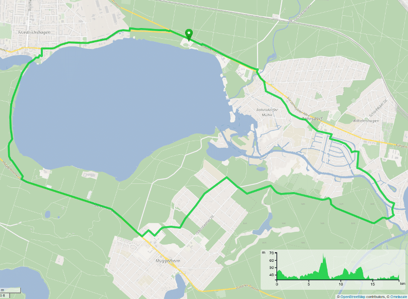
Today we are happy to announce the new release of our open source road routing engine GraphHopper 0.7. It includes many improvements as well as a new round trip calculation for the flexibility mode. A big thanks for this release goes to all of our contributors and translators! To become a contributor see our contributing […]
Today we are proud to release version 0.6 of our open source road routing engine GraphHopper. It includes many smaller improvements as well as a new alternative route calculation for the flexibility mode. In an ealier blog post we made some simple but yet powerful visualizations based on this. Get it now via maven or […]
The roads to rome project from Moovel Labs is a nice visualization of the possibilities with GraphHopper. And it is only the start. While investigating and debugging the quality of alternative routes – a new feature from GraphHopper – we stumbled over the necessity to do a very similar visualizations. The visualization of the so […]
This year goes to an end and it was an exciting year for us, our users and customers. In this blog post we summarize all GraphHopper related activities and wish you happy holidays! GraphHopper Community With the help of our community we’ve now several new features and already over 35 translations! We moved our mailing […]
