Today, we are proud to announce the release of GraphHopper 0.13. GraphHopper is an open source routing engine for roads and public transit, released under the Apache License 2.0. By default it uses OpenStreetMap and GTFS data and it can import other data sources. The demo is called GraphHopper Maps and shows most road routing features; other features like public transit, map matching, navigation and the isochrone calculation are not yet included in this demo. For a list of all features visit the Github repository.
Additional road data like the OSM highway tag (road_class), max_speed, road_access, tunnel/bridge (road_environment), surface, toll, track_type, max_length, max_width, max_height, max_weight can be stored in the graph. We call them “EncodedValue” and it is now easy via Java to add your own data or grab this from OSM via a “TagParser”. #1548
This additional road data can be displayed in the elevation widget if elevation is enabled. #1569
A new high precision isochrone endpoint was added. In fact it is a shortest path tree endpoint and does not return isochrones. The aim is to provide useful information for external tools like for R lang and PostGIS. Thanks @crazycapivara, @michaz and @Komzpa for valuable discussion. #1577
The isochrone response can now be returned as GeoJSON #1651
GraphHopper can now serve vector tiles for debugging purposes (/mvt endpoint) and directly shows road names and some road data on “mouse over”. #1572
location index has now a query(BBox) method which e.g. allowed us to implement the /mvt endpoint and could be even used for offline maps. #1485
Many improvements and bug fixes regarding turn costs and edge based routing.
Elevation interpolation is now turned on by default and much faster. #1649
Snap prevention: with this new feature you avoid that start or end points “snap” to tunnels/ferries/bridges. #1644
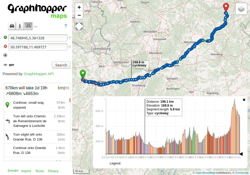
Shows the new elevation widget of the GraphHopper Maps UI and the path details “road_class”. See here for a live example and switch the path details with the small triangle in the bottom right corner of the widget. See this blog post for more information.
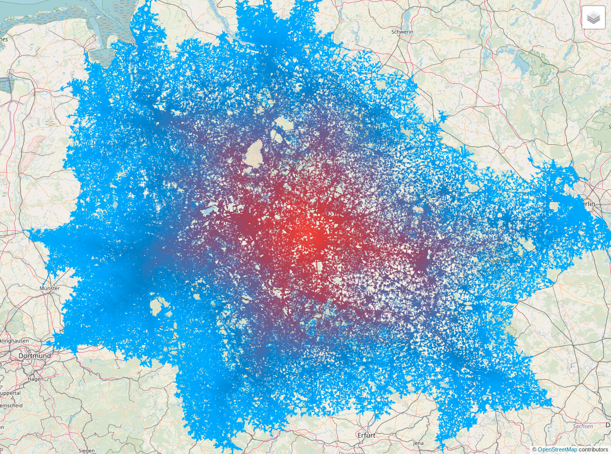
New shortest path tree endpoint:
Country-sized shortest path trees with the new /spt endpointShortest path trees from /spt endpoint fetched from an R Interface to deck.gl
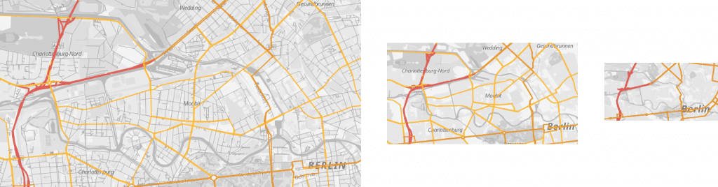
New vector tile endpoint:
GraphHopper serves vector tiles and is compatible with the spec. For different zoom levels the endpoint returns different details based on the road_class (OSM highway tag). Note, that in the screenshots still a background layer is used that draws city and road names.