Don’t hesitate to contact us:
Forum: discuss.graphhopper.com
Email: support@graphhopper.com
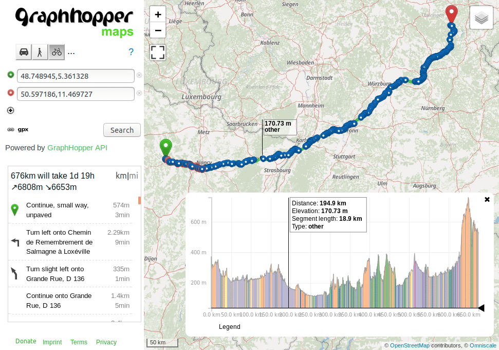
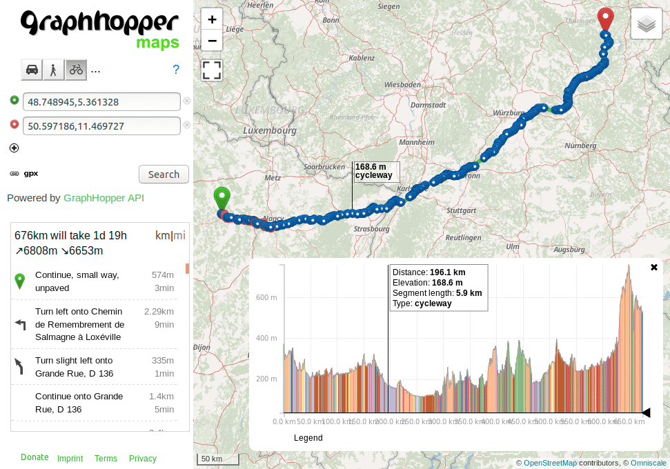
The Routing API has supported path details for 2 years, but had some limitations. E.g. the details like cycleway, or bridleway where missing, which is now returned instead of a generic “other” value. Also path details are now supported for the TomTom add-on.
Before:
Afterwards:
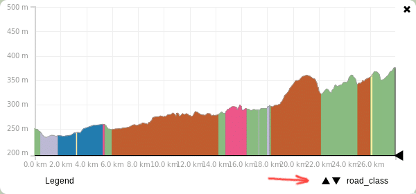
If you want to see this feature in action on GraphHopper Maps you currently have to add two parameters to the URL:
&details=road_class&debug=true
If you add multiple details like
&details=max_speed&details=road_environment&debug=true
you can switch them in the elevation widget in the bottom right corner:
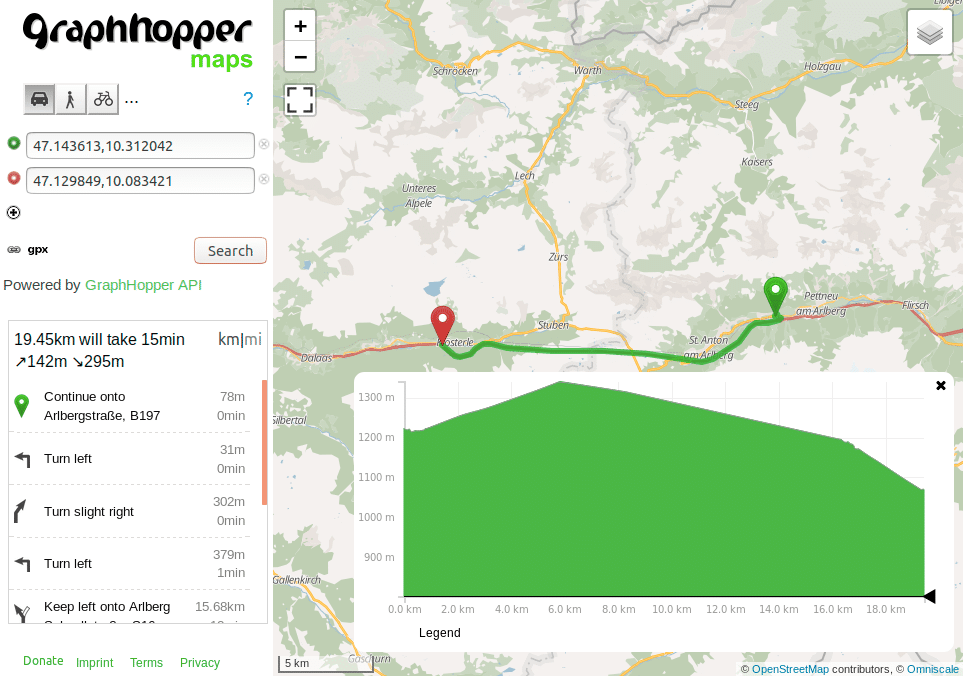
If you include elevation in your response you might have noticed that this is wrong for tunnels: elevation should not be picked from the hill and instead should be interpolated from the start and end elevation. Years ago we got a nice contribution fixing this issue but it wasn’t easily possible to bring this into production due to some limitations and much bigger memory requirements. After a heavy refactoring we were now able to bring this into production. Enjoy also more precise distance and ETA values in mountained area.
Before:
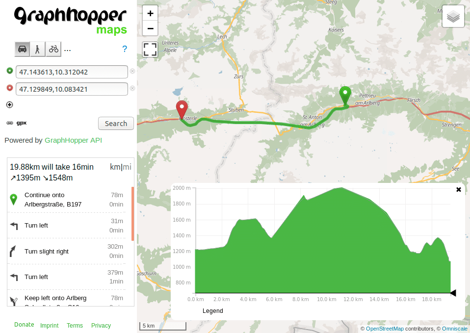
Afterwards. The interpolation does not only improve the ascent (142m vs. 1395m before) and descent (295m vs. 1548m before) but the distance is slightly improved (430m shorter):
Happy Routing!
Your GraphHopper Team
