Don’t hesitate to contact us:
Forum: discuss.graphhopper.com
Email: support@graphhopper.com
The free route planner for your next trip or outdoor adventure. Including many routing profiles like biking, walking, car, truck & more based on OpenStreetMap.
It supports alternative route suggestions and many different map backgrounds. GraphHopper Maps is tuned towards fast and compact response times making it a viable option even for bad network.
It is open source, so you can host it on your own servers or use our privacy-friendly GraphHopper Directions API as a backend, which is hosted in Germany.

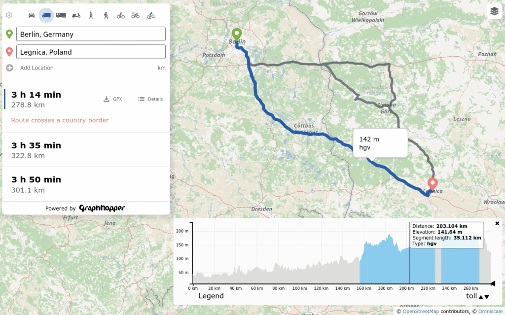
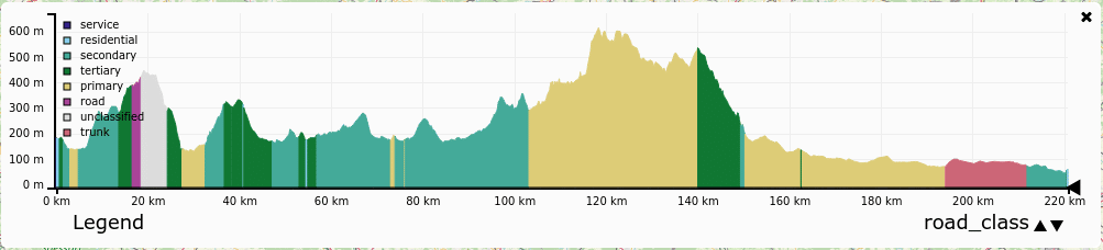
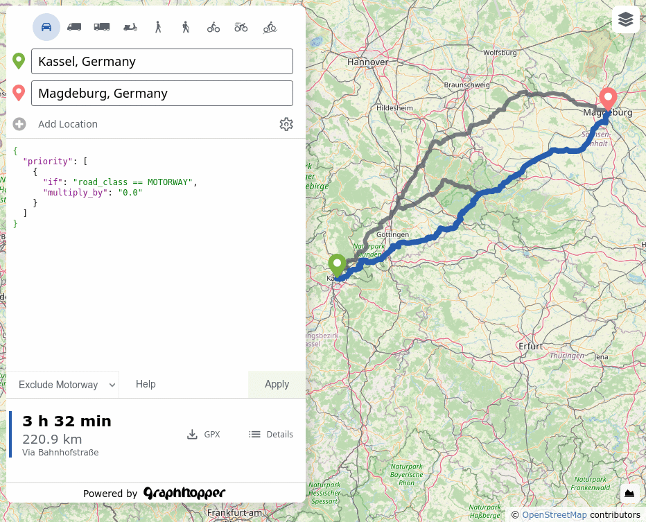
At the bottom right you can see many different details about your route. Select e.g. surface to see the surface details and other details like road class, toll, country are available.
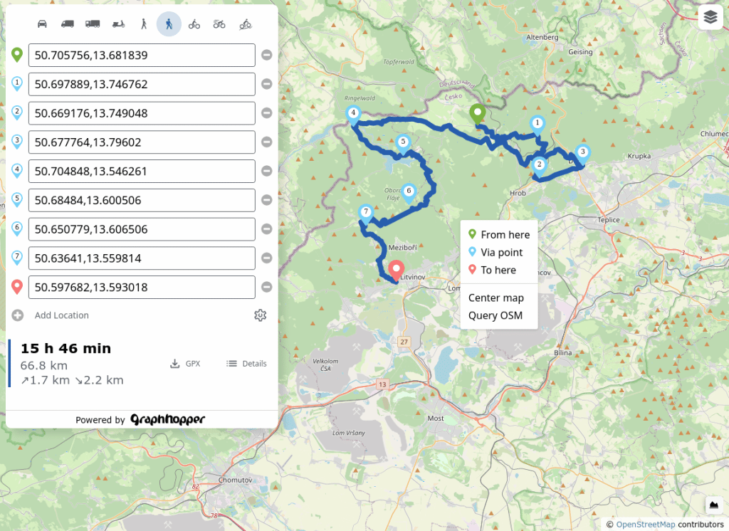
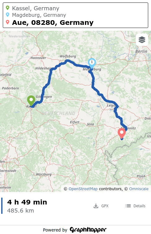
Plan your detailed biking or hiking tour with lots of locations. Right click the map to add via points or add more locations in the sidebar.
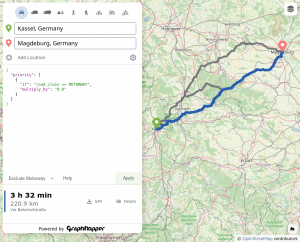
Besides the ‘settings’ where you can simply choose between e.g. avoiding motorways or ferries or selecting the e-cargo-bike there is the powerful custom model (![]() ) you can limit speed, prefer hiking routes and much more. After the route planning you can download the GPX or just copy the URL to share the route with your family, friends or for mobile usage. Try it out with this with this URL.
) you can limit speed, prefer hiking routes and much more. After the route planning you can download the GPX or just copy the URL to share the route with your family, friends or for mobile usage. Try it out with this with this URL.
GraphHopper Maps works on all major mobile browsers like Chrome, Firefox or Safari. We have fine-tuned the user experience so that you can plan your routes on the go. And if you need to view or use the route elsewhere you can just download the GPX.
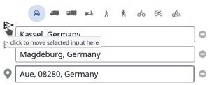
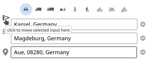
For mobile usage you can even handle dozens of locations in a route and re-order them as you like. Click on the colored pin of the location you want to move and then move it to a different place in the route (![]() ).
).